Isabella Township and Lincoln Township land listings summarized
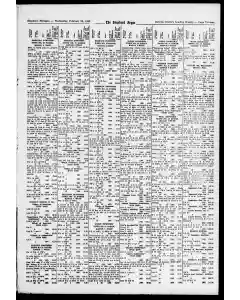
A historical land record snapshot lists parcels in Isabella Township and Lincoln Township with lots, sections, and platted divisions. It notes descriptions such as NW% and SE% fractions, specific acreages, and boundary lines tied to sections, townships, and ranges, including references to Graham's Addition and Lone Oak Subdivision.
MENTIONED IN THIS ARTICLE
Graham
Rosebush
Lone Oak
Land Parcels and Measurements Across Townships and Lots
A compilation of land descriptions across Lincoln, Notta wa, Rolland townships detailing sections, fractions, and coordinates. Includes references to Coldwater Lake Shores and Village of Weidman with multiple parcels described by NW NE SE SW quarters and measured rods and feet dated 1960.
MENTIONED IN THIS ARTICLE
Coldwater Lake Shores
Coldwater Beach
Village of
Weidman
Property Plats and Lots Listed in Township Survey Notes
A detailed 1960 land survey record lists portions of Blanchard and Union townships with lot numbers, fractional sections, and tract descriptions. It includes sections, SE and NE parcels, river and railroad references, and various measurements in rods and feet for parcels near Secs 2 and 15, along with specific acreage notes and corner points.
MENTIONED IN THIS ARTICLE
Union Township
PMRR
Beg
Township 14N 4W land records list lots and subdivisions
A numbered survey ledger details land parcels in Township 14 North Range 4 West. It lists sections and descriptions, including Belmont Park Lot 10 and Lot 12, Blesch Meadows, Carter’s Addition, Damon Suburb parcels, Garden Grove No 2, Hoyle’s Subdivision, Neal’s Subdivision, and Neal’s Lot 10. Entries date from 1960 with varying acreages and lot boundaries.
MENTIONED IN THIS ARTICLE
Sam i
Union Township
North
Range
Belmont Park
Blesch Meadows
Carter’s
Damon Suburb
Dyer’s
Garden Grove No
Hoyle’s
Neal’s
C. Bennett
Land Sections and Lots in Stockman Acres and Ward's Outlets
Property listings describe parcels in Stockman Acres T14N R4W lots 32 33 34 with values 37.84 and Ward's Outlets N percent of Lot 9 1960 110.52 N percent of Lot 10 1960 43.85 S percent of Lot 27 1960 110.51.
MENTIONED IN THIS ARTICLE
Union Township
Stockman Acres
Property lot listings and plats in Loomis Mt Pleasant and surrounding towns
A dense list of land parcels, lots, and sections with measurements, dates, and subdivision names across Wise Township Loomis Mt Pleasant and adjacent areas. It catalogues lots, blocks, meets and bounds, and assessor plat references dated 1960 with figures for land areas and boundaries.
Also Mentioned on This Page
Dal
Isabella Township
Calkinsville
Lincoln Township
Nottawa Township
Lot
T.nt
Rolland Township
Sherman Township
River Road
Chippewa R
Chippewa R. S
State Road
State Rd
Greggs Hill Rd
Old State Rd
N&s
Vernon Township
Wise Township
Brocks Landing
TIGGN
Wateredge Park
TIGN
Hwy
Loomis
City OF
MT. Pleasant
Lot 5 & S
Pickard & College Ave
Ely
Franklin St
Pickard Ave
Swir
Fordyce
Henry & Elm St
Peever
Axtell Terrace
Bennett & Burrows
Boulton’s
Brown and Leaton’s

 This is just the beginning! Our collection holds over 300 years of history, including rare newspapers, obituaries, marriage records, birth records, and so much more—most of which you won’t find anywhere else!