Floodplain terminology overview
Floodplains are lands beside rivers that are usually dry but flood during high water. Building in floodplains risks damage and can alter water flow, increasing flood risk downstream. Flood magnitude is described by recurrence intervals, with a five year flood and a one percent chance of a 100 year flood in any year.
MENTIONED IN THIS ARTICLE
United States Geological Survey
Floodplain rules spark North Lawrence debate hearings planned
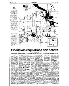
City planners, evolving floodplain rules since 1993 flood recovery, set two July hearings to decide expansion of floodplain boundaries affecting about 2,600 parcels. Critics warn of higher costs and forced insurance. proponents say two foot elevation and broader maps reflect urban growth and reduce future flood damage.
MENTIONED IN THIS ARTICLE
North
Lawrence
Douglas County
LRM Industries
Glass
Bryan Dyer
Floodplain map available for public review in Lawrence
The floodplain study maps are online or in print for $10 at the Lawrence Douglas County Planning Office in City Hall. The planning commission invites public comment at a special meeting from 6:30 to 8 p.m. on July 10 at City Hall. The regular meeting to consider the regulations is scheduled for 6:30 p.m. on July 24.
MENTIONED IN THIS ARTICLE
Lawrence
Thema
Clinton Lake
Linda Finger
North Lawrence
Marilyn Bittenbender
East Hills Business Park
Finger
Lawrence-Douglas County
City Hall
Sixth
Massachusetts Streets
Planning Commission
Also Mentioned on This Page
FEMA
Clinton Parkway
Sixth Street
Ninth Street
Rence
23Rd Street
Stree
East Hills
Ier
Journal-World Graphic
Erty
Steve Glass
Lawrence’s
Federal Emergency Management Agency
Dyer
Jim Turrentine
Yanek
Todd Sutherland
University National Bank
Journal-World
Turrentine
Bittenbender
Joel Mathis

 This is just the beginning! Our collection holds over 300 years of history, including rare newspapers, obituaries, marriage records, birth records, and so much more—most of which you won’t find anywhere else!