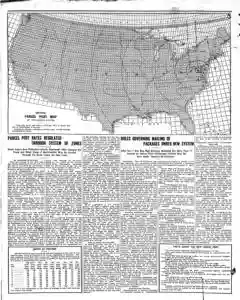
Parcel Post Map of the United States
Fragmentary OCR text presents a parcel post map of the United States with garbled foreign language insertion. No clear dates, places, or figures are readable. The item appears to be a brief catalog card or map illustration note lacking complete context.
MENTIONED IN THIS ARTICLE
Parcel Post Map OF the
United States
Rules Governing Mailing of Parcels Under New System
Postmaster General Hitchcock approves parcel post regulations detailing what can be mailed, weight and zone rates, and packaging requirements. Local rates apply within first zone with specified per pound charges. maximum eleven pounds per parcel and length girth limits.
Parcel Post Zones Map Changes Rates in 35,000 Units
The article explains the new parcel post system with zones and 35,000 units centered on post offices. It details how rates are fixed from the sending unit, how distances and zones affect pricing, and notes a one pound limit and caps for parcels. It mentions possible English style hampers and the exclusion of books from parcel post.
MENTIONED IN THIS ARTICLE
Edward &. Clark
United States
Congress
Sones
Washington
Keokuk
Brom
Ita
Erie
Atlanta Ga
Atlanta
Postoffica
Parcel Post
Interstate Commerce Commission
New Parcel Post Rules Take Effect January 1 1913
The new parcel post goes into operation January 1 1913 and changes which items are mailed. Perishable goods may travel short distances, fresh meats only within sixty miles, and fragile items must be marked as such. Certain items are banned, including intoxicating liquors, explosives, firearms, and live poultry. Weight limit is eleven pounds with a simple measuring method. Regular carriers will deliver parcels where possible and parcels must be mailed at post offices with special stamps.
MENTIONED IN THIS ARTICLE
Parcel Post
Publc
Post Office Department
Drity
Also Mentioned on This Page
Sao “I Saale
City of
Hitchcock
Bo Ag
Bega
Uncle Sam
Eace
Paracel Post
NEW Parcel Post

 This is just the beginning! Our collection holds over 300 years of history, including rare newspapers, obituaries, marriage records, birth records, and so much more—most of which you won’t find anywhere else!